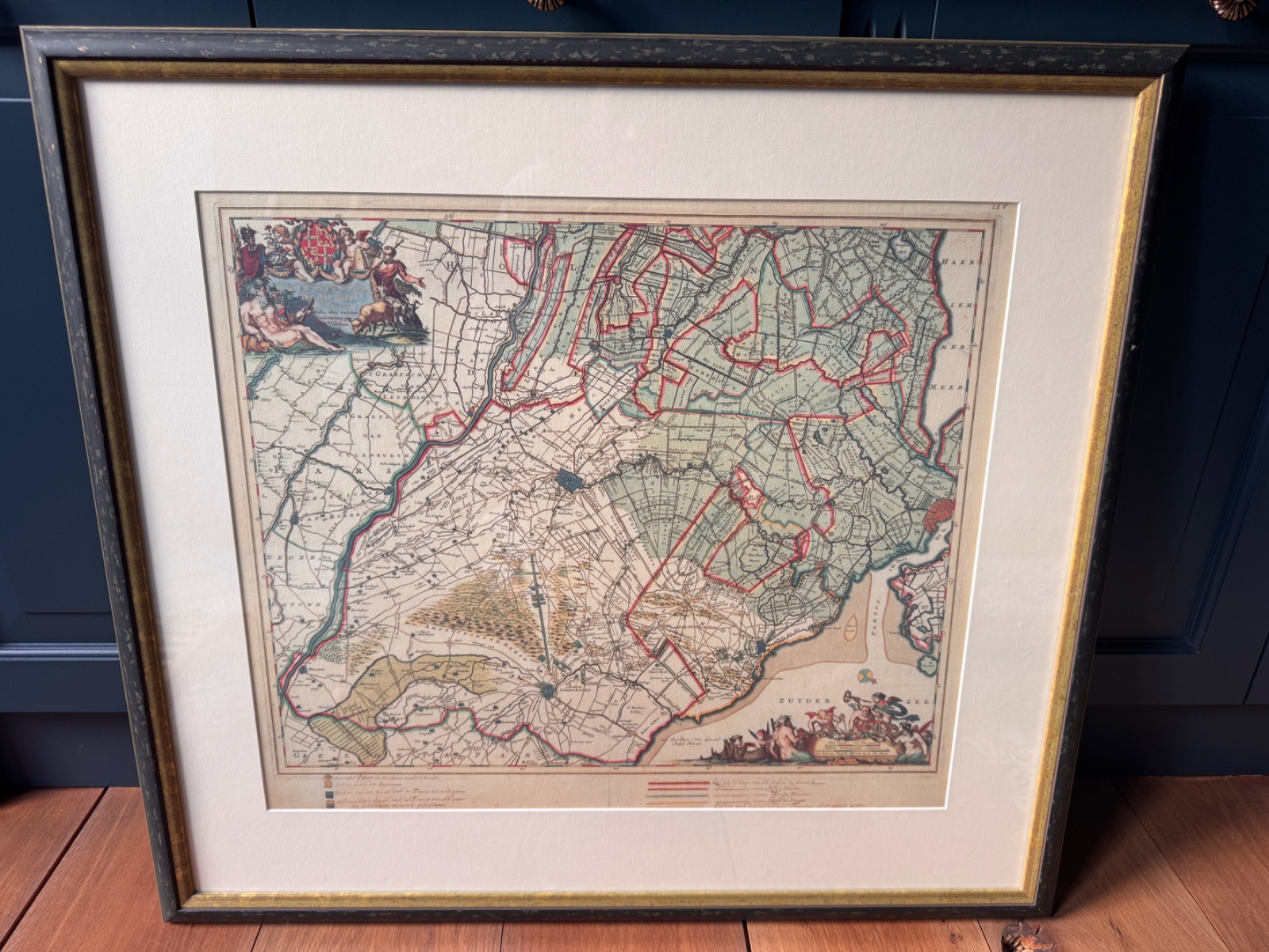
Antique Map of Holland and Utrecht by Willem Janszoon Blaeu, c. 1650-1660
Estimated value
$800 - $2,500Rarity
Uncommon(5/10)Category
Maps & GlobesBrand
Blaeu (likely Joan Blaeu or Willem Janszoon Blaeu's firm)Era
c. 1650-1660Origin
🇳🇱 NetherlandsArtist / Creator
Willem Janszoon Blaeu (likely the father or son from the Blaeu workshop)Authenticity
ANTIQUE MAP OF HOLLAND AND UTRECHT BY WILLEM JANSZOON BLAEU, C. 1650-1660: IDENTIFICATION
This appears to be an engraved map depicting the regions of Holland and Utrecht, with the Zuiderzee prominently featured. The cartographic style, decorative cartouche, and mythological figures in the Zuiderzee suggest a mid-17th-century Dutch origin. The use of hand-coloring, likely contemporary or early, enhances the legibility of the political boundaries and geographic features, which was a hallmark of Dutch cartography during its Golden Age. The map is framed, indicating it's been prepared for display and preservation.
COLLECTOR NOTES
The 'Zuiderzee' (Southern Sea) depicted in the map was a large inland bay in the Netherlands that was largely dammed off in 1932 to form the freshwater IJsselmeer, a significant Dutch engineering feat.
SCARCITY
Genuine antiques with fewer examples on the market. Named makers, documented provenance, or early production examples.
Rarity 5/10. Curiosa currently catalogues 1 maps item at rarity 5 or higher.
Typical Characteristics
- Limited production
- Named makers
- Growing collector demand
Confidence Factors
- High market value of Blaeu maps makes them targets for reproductions or later impressions.
- Difficulty in definitively verifying the originality of the hand-coloring from images alone.
- Lack of visible watermark or verso details to confirm paper and edition without physical inspection.
CARTOGRAPHY SPECIALIST'S TAKE
Cartographic Specialist & Antiquarian Dealer
My confidence is high due to the distinctive style, immediately recognizable decorative elements, and identifiable region consistent with a cartographer like Blaeu. The visible geographical features and ornamental border align strongly with known Blaeu works from the mid-17th century, specifically his atlas maps of the Low Countries.
KEY EVIDENCE
- 1Decorative cartouches and mythological figures in the sea, highly characteristic of 17th-century Dutch cartography.
- 2Fine copperplate engraving visible in the detailed lines and topography.
- 3Hand-coloring with clear demarcation of political boundaries and features.
- 4Text 'ZUYDER ZEE' and general design consistent with works by the Blaeu family.
- 5Label in lower left appears to relate to 'Hollandiae et Ultrajectinae Partis Occidentalis' by Blaeu.
UNCERTAINTIES
- •The presence of framing prevents inspection of the verso (back) for watermarks or previous collection stamps.
- •It's difficult to ascertain if the coloring is original contemporary hand-coloring or later skillful enhancement without closer physical examination and comparison.
- •Precise edition (e.g., specific state within the Grand Atlas series) cannot be determined without clearer examination of any textual variants or plate characteristics.
WHAT WOULD IMPROVE CERTAINTY
- →Remove from frame and examine the verso for watermarks, especially against transmitted light, and any publisher's text or stamps.
- →Measure the full sheet size and plate marks (the indentation created by the copperplate) to compare against known dimensions for Blaeu maps.
- →Inspect the coloring under magnification to confirm consistency or signs of later application.
- →Compare the specific geographical details and decorative elements with known states and editions of Blaeu's map of this region (e.g., 'Hollandiae et Ultrajectinae Partis Occidentalis').
CONDITION & GRADE
Condition
The map appears to be in good collectible condition, framed and likely protected behind glass. There is some visible age-toning and potentially minor foxing consistent with a 350+ year old print. The margins seem adequate, not trimmed into the plate mark, which is a key factor for antique maps. The coloring is well preserved.
MAP MARKET VALUATION
Updated: Feb 27, 2026
- Market comparables from auctions & retail
- Condition, completeness & craftsmanship
- Current collector demand & trends
- Low = quick sale, high = patient seller
For informational purposes only, not a formal appraisal.
SIMILAR CURIOSITIES
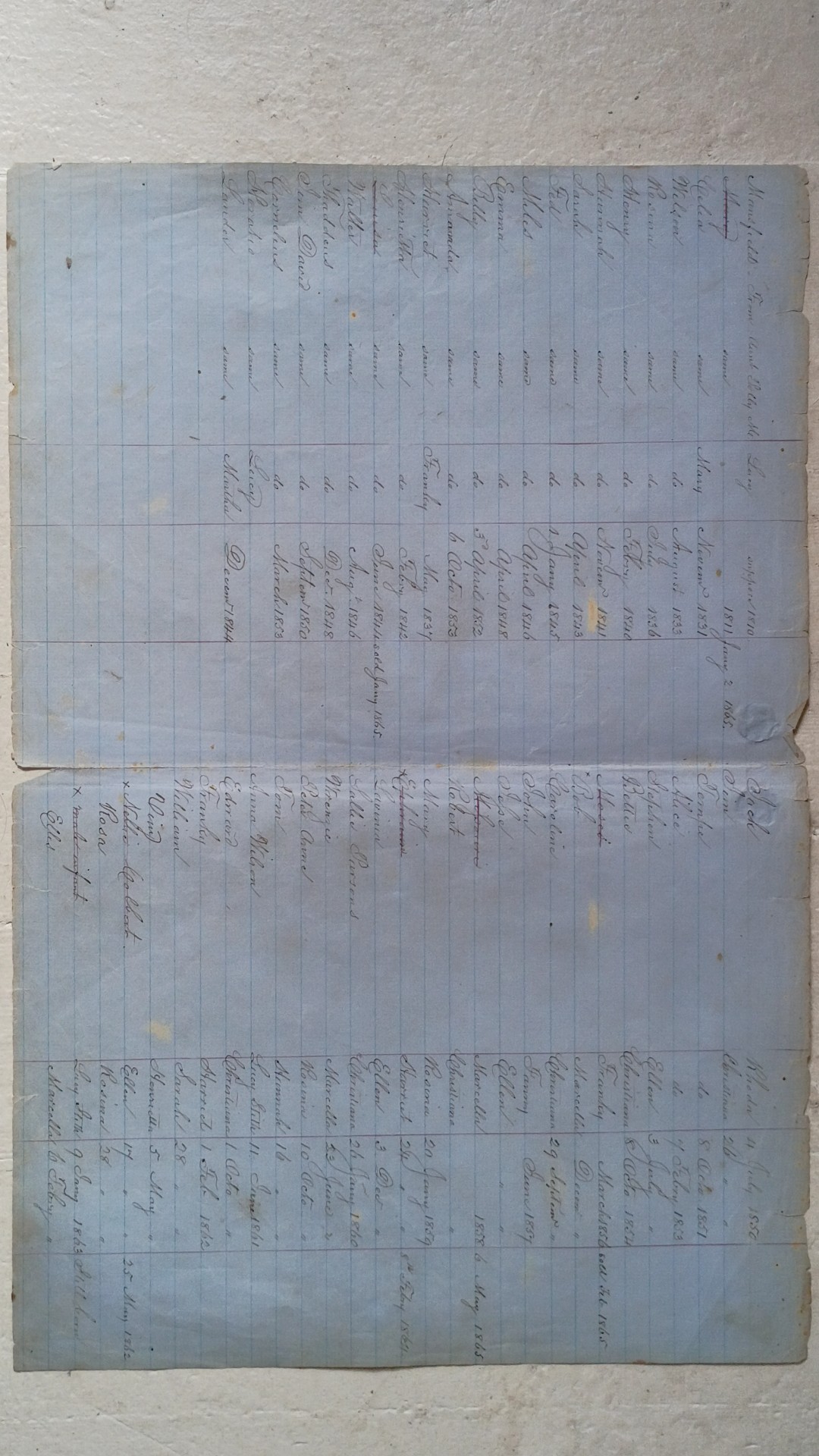
Mid-19th Century Slave Ledger (Register of Negroes)
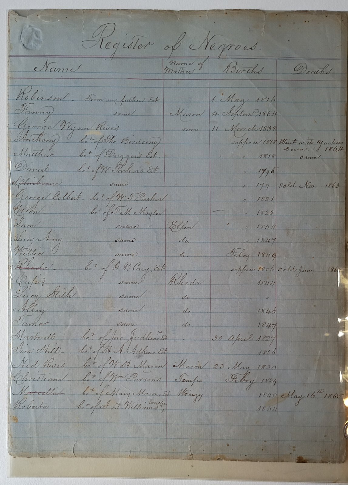
Mid-19th Century Plantation Slave Ledger Page
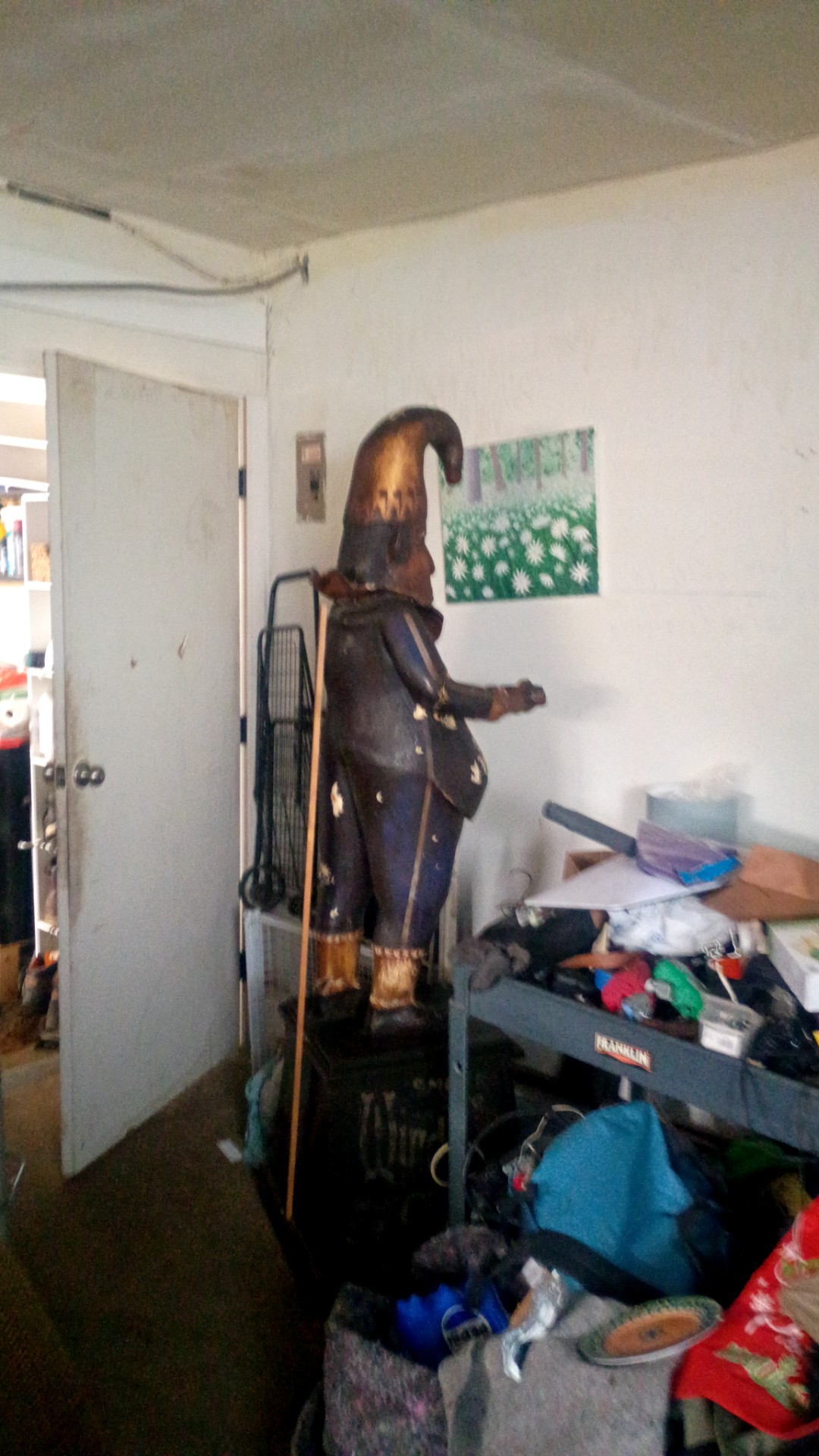
Carved Wooden Punch Figure Cigar Store Style Tobacconist Figure
The True Briton, No. LII (December 30, 1723)
Catholic Donor Recognition Broadside - Early 20th Century Lithograph
Atlas of Finland
ABOUT MAPS & GLOBES
Antique maps, atlases, celestial charts, and terrestrial globes.
Maps & Globes value and rarity guideSHARE THIS CURIOSITY
Have your own curiosities to discover?
Scan Your Curiosity
COMMENTS
No comments yet. Be the first to share your thoughts!
Sign in to leave a comment